With heavy rainfall, thunderstorms, and locally gale-force southeasterly winds reaching up to 10 Beaufort, the severe weather that swept through several regions of Greece and left behind two fatalities—a 56-year-old woman in Ano Glyfada and a coast guard officer in Astros Kynourias—is expected to continue today, Thursday.
Already since Wednesday evening, a 112 alert has been sent for the Northern Aegean Region, urging residents to limit travel to absolutely necessary movements only.
Closed roads in Attica
According to the latest update from the Hellenic Police (ELAS) at 5:00 a.m. on Thursday for the Attica region, traffic has been suspended on the following roads:
- Eirinis Street (Nea Makri) from Kalavryton Street to Agias Paraskevis Street, due to subsidence of the road surface at its junction with Agiou Efrem Street (from 16:50 on 21/01/2026).
- Coastal unnamed road (Oropos) from the point of the Provincial Road Amfiareio–Chalkoutsi in the direction toward Agioi Apostoloi (from 19:40 on 21/01/2026).
- Anoixeos Street from Marconi Street to Igoumenitsas Street (Athens), in both traffic directions (from 22:25 on 21/01/2026).
- Arionos Street (Rafina) from the height of Marathonos Avenue (from 23:46 on 21/01/2026).
- Poseidonos Avenue (Nea Makri) from the height of Agia Marina Street (from 02:16 on 22/01/2026).
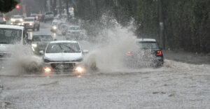
Flooded roads and hundreds of calls to the Fire Service
Serious problems were recorded on Attica’s road network, with streets turning into torrents and dozens of vehicles becoming immobilized. Drivers required assistance from the Fire Service to be transferred to safe locations.
The most severe problems were observed in Glyfada, Voula, Vari, Vouliagmeni, Oropos, Koropi, Nea Makri, and the Municipality of Saronikos. The Fire Service Operations Center received more than 450 calls, mainly for water pumping, assistance provision, and tree cutting—a number expected to rise.
At the same time, disruptions were reported in the operation of the Electric Railway (ISAP) and the Tram in the Moschato and Kallithea areas.
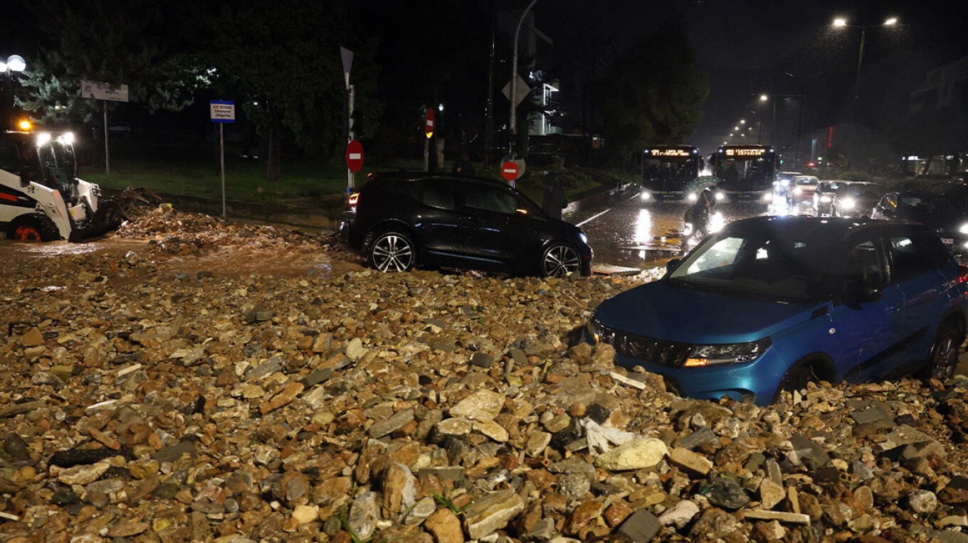
Landslides and torrents in Oropos
In Oropos, continuous and intense rainfall caused landslides in the Agioi Apostoloi area, resulting in the closure of part of the road network, while many side streets were transformed into torrents.
112 alerts for Rafina and Aspropyrgos
Shortly before midnight, a 112 message was sent to residents near the estuary of the Great Stream of Rafina, calling on them to move toward the Rafina Town Hall due to overflow.
Earlier, a similar alert had been issued for the Gkorytsa area of Aspropyrgos, due to the overflow of the Agios Ioannis stream.
Updated Emergency Weather Deterioration Bulletin from the Hellenic National Meteorological Service (EMY)
The Hellenic National Meteorological Service warns that severe weather will continue today, Thursday, January 22, 2026, with heavy rain, thunderstorms, and locally gale-force southeasterly winds of up to 10 Beaufort, mainly in the eastern Aegean, the Cyclades, and the Dodecanese.
More specifically:
A. Heavy rain and thunderstorms are forecast:
a. In the islands of the northern and eastern Aegean (Northern Aegean Region) until midday on Thursday, 22/01/2026,
b. In the Dodecanese from early Thursday morning, 22/01/2026, until the afternoon, and
c. In the Cyclades temporarily during the early morning hours of Thursday, 22/01/2026.
It is noted that the phenomena will be particularly intense and pose increased danger in the islands of the northern and eastern Aegean.
B. Very strong southeasterly winds of 8 to 10 Beaufort will blow until midday on Thursday, 22/01/2026, in the eastern Aegean (Dodecanese, eastern Cyclades, and islands of the eastern Aegean).
Civil Protection urges citizens to be especially cautious and to strictly follow the instructions of the authorities.
Today’s weather
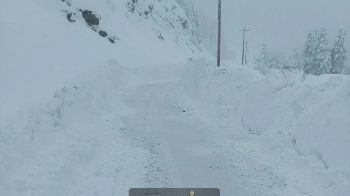
Rain and thunderstorms are forecast in western and southern areas and gradually in eastern regions, locally strong in southern Peloponnese, eastern Attica, Evia, the islands of the northern and eastern Aegean, and from the evening hours in Crete. Snowfall will occur in the mountainous areas of central and northern mainland Greece.
Temperatures will range from:
- Western Macedonia: -4 to 6°C
- Rest of Macedonia: 1 to 10°C
- Thrace: -2 to 7°C
- Epirus: 3 to 12°C
- Thessaly: 1 to 8°C
- Central Greece: 1 to 14°C
- Peloponnese: 4 to 13°C
- Ionian Islands: 10 to 14°C
- Northern Aegean islands: 7 to 13°C
- Remaining Aegean islands: 10 to 17°C
- Crete: 11 to 18°C
Winds will blow from southern to southwesterly directions in the west at 3–6 Beaufort, in the southern Ionian at 4–6 and locally 7 Beaufort. In the east, southeasterly winds at 3–5 Beaufort, in the south 6, in the eastern regions 7, and in the southeastern areas up to 8 Beaufort.
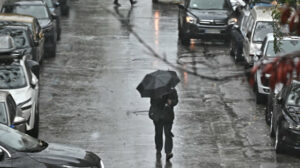
In Attica, rain and thunderstorms are expected, intensifying from midday. Winds will blow from southern directions at 3–5 Beaufort and up to 6 Beaufort in southern areas. Temperatures will range from 6 to 14°C.
In Thessaloniki, rain and snowfall in mountainous areas are forecast until midday. Winds will be northwesterly at 3–5 Beaufort, and up to 6 Beaufort in the Thermaic Gulf. Temperatures will range from 2 to 9°C.
Weather on Friday, 23/01/2026
In the Cyclades, Crete, the Dodecanese, and the islands of the eastern Aegean, increased cloudiness with rain and mainly in the Dodecanese scattered thunderstorms. In the rest of the country, few clouds temporarily increasing with local rain mainly in western areas, southern Peloponnese, and during the morning hours in eastern Central Greece and Evia.
Winds will blow from southern directions at 3–5 Beaufort and temporarily locally in the Aegean up to 6 Beaufort.
Temperatures will rise slightly in the north, reaching 12–13°C in northern mainland areas, 14–16°C in the rest of the country, and 17–18°C in the Cyclades, Crete, and the Dodecanese.
Weather on Saturday, 24/01/2026
In western and southern regions and the eastern Aegean, increased cloudiness with rain and scattered thunderstorms mainly in marine and coastal areas. In the remaining regions, few clouds temporarily increasing with local rain mainly in central and northern areas. Light snowfall will occur in the mountainous areas of Epirus and western Macedonia.
Winds will be southerly to southwesterly at 4–5 Beaufort and locally up to 6 Beaufort, with a strengthening trend from the evening.
Temperatures will not show any significant change.
Weather on Sunday, 25/01/2026
Initially in western, northern, and eastern Aegean regions and gradually in almost the entire country, increased cloudiness with rain and scattered thunderstorms, possibly locally strong in the northwest. Snowfall will occur in the mountainous areas of central and northern Greece.
Winds will blow from southern to southwesterly directions at 5–7 Beaufort and locally up to 8 Beaufort over the seas.
Temperatures will show a slight rise.
Ask me anything
Explore related questions